
CIA Confidential Map of Tibet (February 1950)
Shows the ethnographic boundary of Tibet (1912-1950) just before the Chinese advance.

Source: U.S. Central Intelligence Agency (declassified)
Survey of India Map: Highlands of Tibet and Surrounding Regions (1936)
Depicts Tibet as a distinct highland region during the de facto independent era.
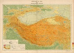
Source: Survey of India
McMahon Line Detail from Simla Accord Treaty Map (1914)
Focuses on the eastern border defined in the convention between Britain and Tibet.
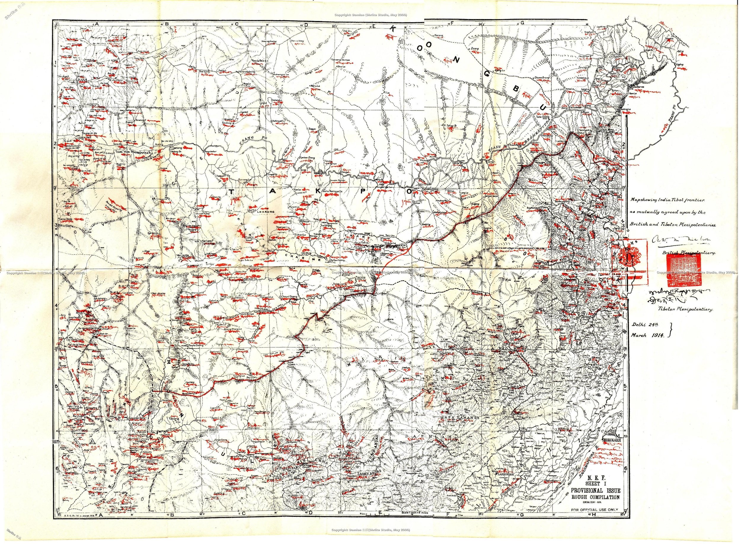
Source: Original treaty annex